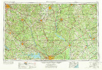
1953 Map of Spartanburg
USGS Topo · Published 1973About this map
The Columbia and Spartanburg corridor during the mid-century shows a landscape defined by massive hydroelectric projects and sprawling textile-era towns. The expansion of Lake Murray behind the Dreher Shoals Dam and the waters of Lake Wateree illustrate the transformation of the state's river systems into power reservoirs. The dominance of the Southern Railway and the Seaboard Coast Line networks reveals the critical logistics that once bound together manufacturing hubs like Rock Hill, Chester, and Lancaster.
Find a feature on this map
65 named features on this map. Tap any name to fly to it.
Don’t see what you’re looking for? This feature index may not catch every label — zoom into the map to look around manually.
Map Details
Editions of this 1953 Spartanburg Map
4 editions found

Other maps of this area

1892 · Mc Cormick
USGS Topo · 1:125,000

1892 · Abbeville
USGS Topo · 1:125,000

1904 · Columbia
USGS Topo · 1:125,000

1905 · Charlotte
USGS Topo · 1:48,000

1906 · Kings Mountain
USGS Topo · 1:62,500

1907 · Sharon
USGS Topo · 1:62,500

1907 · Saluda
USGS Topo · 1:125,000

1907 · Charlotte
USGS Topo · 1:62,500

1908 · Kings Mountain
USGS Topo · 1:62,500

1908 · Kirksey
USGS Topo · 1:24,000