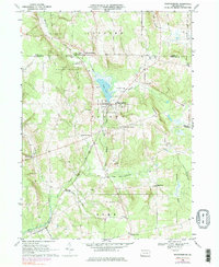
1968 Map of Spartansburg
USGS Topo · Published 1984About this map
The town of Spartansburg serves as the focal point of this rural landscape where Crawford and Erie counties meet. Situated along the Penn Central railroad line, the village is bordered by Clear Lake and the winding Patrick Run. The surrounding countryside is defined by several crossroads hamlets, including Concord Corners, Blakeslee Corners, and Merchant Corners, indicating a pattern of small-scale agricultural commerce and local community hubs established at major intersections.
Find a feature on this map
32 named features on this map. Tap any name to fly to it.
Don’t see what you’re looking for? This feature index may not catch every label — zoom into the map to look around manually.
Map Details
Editions of this 1968 Spartansburg Map
4 editions found
Other maps of this area

1927 · Townville
USGS Topo · 1:48,000

1927 · Titusville
USGS Topo · 1:62,500

1929 · Corry
USGS Topo · 1:48,000

1929 · Union City
USGS Topo · 1:62,500

1932 · Corry
USGS Topo · 1:62,500

1932 · Townville
USGS Topo · 1:62,500

1932 · Union City
USGS Topo · 1:62,500

1933 · Titusville
USGS Topo · 1:62,500

1945 · Townville
USGS Topo · 1:62,500

1957 · Warren
USGS Topo · 1:250,000