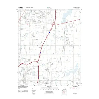
2012 Map of Spencer
USGS Topo · Published 2012About this map
The Deep Fork and North Canadian River valley east of Oklahoma City showcases the suburban and recreational development of the early 21st century. High-speed transit corridors like the John Kilpatrick Tpke E slice through the landscape, connecting established communities such as Spencer and Witcher. The map highlights a significant concentration of commemorative and educational sites, including Oklahoma Christian Univ and several prominent burial grounds like Arlington Memory Gardens and the Oklahoma Veterans Cem. Large-scale public features such as Remington Park and Northeast Lake illustrate the area's role as a regional hub for leisure and sporting activities. The transition from the residential grids of Forest Park to the expansive waters of Lake Arcadia in the northeast corner reveals a diverse geography where managed water resources and transportation infrastructure define the modern landscape of Oklahoma County.
Find a feature on this map
92 named features on this map. Tap any name to fly to it.
Don’t see what you’re looking for? This feature index may not catch every label — zoom into the map to look around manually.
Map Details
Editions of this 2012 Spencer Map
This is the sole edition of this map. No revisions or reprints were ever made.
Other maps of this area

1892 · Moore
USGS Topo · 1:62,500

1892 · Edmond
USGS Topo · 1:62,500

1892 · Kingfisher
USGS Topo · 1:125,000

1893 · Oklahoma City
USGS Topo · 1:62,500

1895 · Kingfisher
USGS Topo · 1:125,000

1898 · Purcell
USGS Topo · 1:125,000

1904 · Chickasha
USGS Topo · 1:125,000

1934 · Crutcho Creek
USGS Topo · 1:24,000

1934 · Moore
USGS Topo · 1:62,500

1935 · Spencer
USGS Topo · 1:24,000