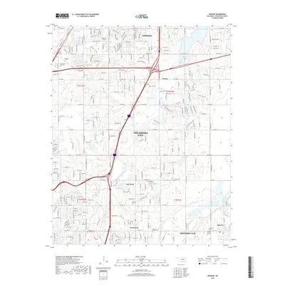
2018 Map of Spencer
USGS Topo · Published 2018About this map
Oklahoma City and its northeastern suburbs form a dense suburban landscape where the North Canadian River and Deep Fork define the drainage patterns of Oklahoma County. This 2018 survey documents the expansion between Edmond and Midwest City, centering on the small community of Lake Aluma and the town of Spencer. The map is particularly useful for genealogists, as it identifies numerous burial sites including Witcher Cem, Trice Hill Cem, and East View Cem, alongside the Oklahoma Veterans Cem. Water management is a primary feature of the local topography, represented by Lake Arcadia in the northeast and the Reservoir near Witcher. Education and recreation are also prominent, with the campus of Oklahoma Christian U and the Bayliner Launch providing modern landmarks within this developed corridor.
Find a feature on this map
227 named features on this map. Tap any name to fly to it.
Don’t see what you’re looking for? This feature index may not catch every label — zoom into the map to look around manually.
Map Details
Editions of this 2018 Spencer Map
This is the sole edition of this map. No revisions or reprints were ever made.
Other maps of this area

1892 · Moore
USGS Topo · 1:62,500

1892 · Edmond
USGS Topo · 1:62,500

1892 · Kingfisher
USGS Topo · 1:125,000

1893 · Oklahoma City
USGS Topo · 1:62,500

1895 · Kingfisher
USGS Topo · 1:125,000

1898 · Purcell
USGS Topo · 1:125,000

1904 · Chickasha
USGS Topo · 1:125,000

1934 · Crutcho Creek
USGS Topo · 1:24,000

1934 · Moore
USGS Topo · 1:62,500

1935 · Spencer
USGS Topo · 1:24,000