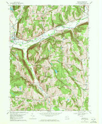
1969 Map of Spencer
USGS Topo · Published 1971About this map
Spencer stands as the primary hub in this late 1960s topographic study, situated where the Lehigh Valley railroad tracks trace the valley floor alongside Catatonk Creek. The landscape transitions from the developed corridors of West Candor and Seelytown into the steep, wooded rises of Dawson Hill and Emery Hill. Genealogists will find significant detail in the rural cemeteries and churches that anchor these valley communities, including the Baptist Corners Cem and the Straits Corners Ch.
Find a feature on this map
64 named features on this map. Tap any name to fly to it.
Don’t see what you’re looking for? This feature index may not catch every label — zoom into the map to look around manually.
Map Details
Editions of this 1969 Spencer Map
3 editions found
Other maps of this area

1893 · Ithaca
USGS Topo · 1:62,500

1895 · Ithaca
USGS Topo · 1:62,500

1900 · Dryden
USGS Topo · 1:62,500

1902 · Waverly
USGS Topo · 1:62,500

1903 · Owego
USGS Topo · 1:62,500

1905 · Watkins Glen
USGS Topo · 1:125,000

1906 · Catatonk
USGS Topo · 1:125,000

1949 · Willseyville
USGS Topo · 1:24,000

1949 · Speedsville
USGS Topo · 1:24,000

1950 · Elmira
USGS Topo · 1:250,000