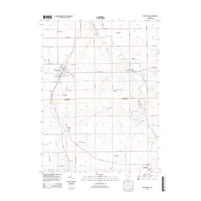
2013 Map of Spencerville
USGS Topo · Published 2013About this map
The Auglaize River and Saint Marys River define the hydraulic character of this West-Central Ohio landscape, where the border of Allen and Auglaize Counties meets. Significant local history is preserved in the numerous rural burial grounds, including the Ft Amanda Cem and Christie Chapel Cem. The village of Spencerville serves as the primary hub, showing a detailed street grid including N Canal St and S Broadway St. The geography here transitions from the clustered settlement at Buckland to the open agricultural fields surrounding Kossuth and Conant. A prominent hydrological feature known as Deep Cut appears in the western portion of the sheet, while Lake Amanda provides a distinct water body along the river's path. These landmarks, combined with smaller waterways like Sixmile Cr and Jennings Cr, illustrate the drainage patterns essential to the region's development.
Find a feature on this map
132 named features on this map. Tap any name to fly to it.
Don’t see what you’re looking for? This feature index may not catch every label — zoom into the map to look around manually.
Map Details
Editions of this 2013 Spencerville Map
This is the sole edition of this map. No revisions or reprints were ever made.
Other maps of this area

1906 · Lima
USGS Topo · 1:62,500

1906 · Columbus Grove
USGS Topo · 1:62,500

1908 · Columbus Grove
USGS Topo · 1:62,500

1911 · Spencerville
USGS Topo · 1:62,500

1911 · Delphos
USGS Topo · 1:62,500

1944 · Delphos
USGS Topo · 1:62,500

1944 · Spencerville
USGS Topo · 1:62,500

1953 · Muncie
USGS Topo · 1:250,000

1956 · Muncie
USGS Topo · 1:250,000
1960 · Delphos
USGS Topo · 1:24,000