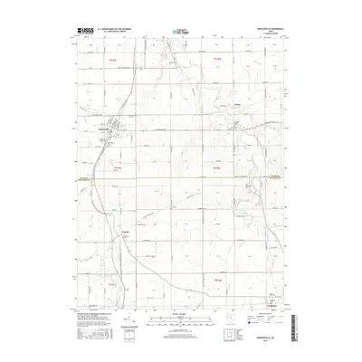
2016 Map of Spencerville
USGS Topo · Published 2016About this map
The Saint Marys River and Auglaize River frame this section of western Ohio, where the grid of rural roads meets significant local history landmarks. Spencerville serves as the primary hub, showing a detailed street layout from N Main St to Wisher Dr. The landscape is dotted with ancestral burial grounds, including the Fort Amanda Cem and Amanda Baptist Cem, which reflect the early settlement of the Allen Co and Auglaize Co borderlands. Smaller communities like Kossuth, Conant, and Buckland are clearly defined, surrounded by a complex drainage network featuring Sixmile Cr, Honey Run, and Sims Run. The presence of the Deep Cut indicates the region's engineered waterway history, while the proximity of the Buckeye Trail through sections like t4s r4e highlights the local recreational geography.
Find a feature on this map
108 named features on this map. Tap any name to fly to it.
Don’t see what you’re looking for? This feature index may not catch every label — zoom into the map to look around manually.
Map Details
Editions of this 2016 Spencerville Map
This is the sole edition of this map. No revisions or reprints were ever made.
Other maps of this area

1906 · Lima
USGS Topo · 1:62,500

1906 · Columbus Grove
USGS Topo · 1:62,500

1908 · Columbus Grove
USGS Topo · 1:62,500

1911 · Spencerville
USGS Topo · 1:62,500

1911 · Delphos
USGS Topo · 1:62,500

1944 · Delphos
USGS Topo · 1:62,500

1944 · Spencerville
USGS Topo · 1:62,500

1953 · Muncie
USGS Topo · 1:250,000

1956 · Muncie
USGS Topo · 1:250,000
1960 · Delphos
USGS Topo · 1:24,000