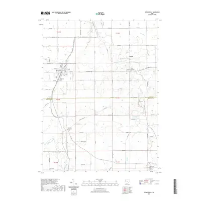
2019 Map of Spencerville
USGS Topo · Published 2019About this map
Spencerville and its surrounding rural landscapes in Allen and Auglaize Counties are defined by a network of historic cemeteries and waterways. This modern survey shows a region where small settlements like Kossuth and Buckland are linked by a grid of farm-to-market roads and the winding course of the Auglaize River. Genealogists will find a wealth of named burial sites, from the centrally located Zion Cem to the family-named Jacob Baker Cem and the prominent Fort Amanda Cem. The N Country National Scenic Trail winds through the western half of the map, following the path of the Saint Marys River and offering a contemporary look at the preservation of the landscape near Spencerville Cem. The terrain is characterized by gentle drainage patterns like Sims Run and Honey Run, which feed into the primary river systems that have sustained these communities for generations.
Find a feature on this map
114 named features on this map. Tap any name to fly to it.
Don’t see what you’re looking for? This feature index may not catch every label — zoom into the map to look around manually.
Map Details
Editions of this 2019 Spencerville Map
This is the sole edition of this map. No revisions or reprints were ever made.
Other maps of this area

1906 · Lima
USGS Topo · 1:62,500

1906 · Columbus Grove
USGS Topo · 1:62,500

1908 · Columbus Grove
USGS Topo · 1:62,500

1911 · Spencerville
USGS Topo · 1:62,500

1911 · Delphos
USGS Topo · 1:62,500

1944 · Delphos
USGS Topo · 1:62,500

1944 · Spencerville
USGS Topo · 1:62,500

1953 · Muncie
USGS Topo · 1:250,000

1956 · Muncie
USGS Topo · 1:250,000
1960 · Delphos
USGS Topo · 1:24,000