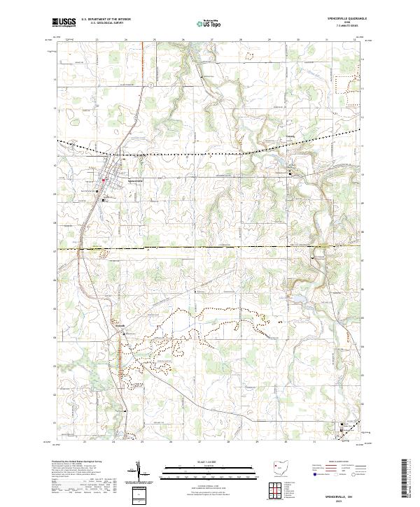
2023 Map of Spencerville
USGS Topo · Published 2023About this map
Spencerville serves as the primary hub of this landscape, situated at the intersection of local routes like Spencerville Rd and Saint Marys Rd. The terrain is shaped by the winding Auglaize River and Saint Marys River, with smaller tributaries such as Sixmile Creek and Jennings Creek cutting through the farmland. A notable concentration of memorial sites, including the Fort Amanda National Cem near the riverbanks and the centrally located Saint Patricks Cem, provide significant touchpoints for genealogical research and local heritage.
Find a feature on this map
85 named features on this map. Tap any name to fly to it.
Don’t see what you’re looking for? This feature index may not catch every label — zoom into the map to look around manually.
Map Details
Editions of this 2023 Spencerville Map
This is the sole edition of this map. No revisions or reprints were ever made.
Other maps of this area

1906 · Lima
USGS Topo · 1:62,500

1906 · Columbus Grove
USGS Topo · 1:62,500

1908 · Columbus Grove
USGS Topo · 1:62,500

1911 · Spencerville
USGS Topo · 1:62,500

1911 · Delphos
USGS Topo · 1:62,500

1944 · Delphos
USGS Topo · 1:62,500

1944 · Spencerville
USGS Topo · 1:62,500

1953 · Muncie
USGS Topo · 1:250,000

1956 · Muncie
USGS Topo · 1:250,000
1960 · Delphos
USGS Topo · 1:24,000