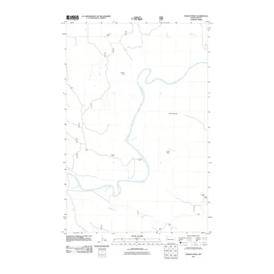
2011 Map of Sperati Point
USGS Topo · Published 2011About this map
The Little Missouri River carves a deep, winding path through this corner of the North Dakota Badlands, defining the landscape around Sperati Point. This 2011 survey documents a sparsely populated ranching region where family-named operations like the O Larson Ranch, Ceynar Ranch, and Kellogg Ranch are the primary markers of human presence. The topography is defined by the sharp transition from the river bottom to the high ground of the Achenbach Hills.
Find a feature on this map
17 named features on this map. Tap any name to fly to it.
Don’t see what you’re looking for? This feature index may not catch every label — zoom into the map to look around manually.
Map Details
Editions of this 2011 Sperati Point Map
This is the sole edition of this map. No revisions or reprints were ever made.
Other maps of this area

1953 · Watford City
USGS Topo · 1:250,000

1957 · Watford City
USGS Topo · 1:250,000

1958 · Long X Divide
USGS Topo · 1:24,000

1958 · Sperati Point
USGS Topo · 1:24,000

1958 · Stocke Butte
USGS Topo · 1:24,000

1958 · Tepee Buttes
USGS Topo · 1:24,000

1967 · Watford City
USGS Topo · 1:250,000

1972 · Bear Butte
USGS Topo · 1:24,000

1974 · Wolf Coulee
USGS Topo · 1:24,000

1974 · Buckskin Butte
USGS Topo · 1:24,000