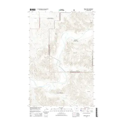
2014 Map of Sperati Point
USGS Topo · Published 2014About this map
The Little Missouri River carves a sharp, serpentine path through this McKenzie County landscape, defining the boundary between two major federal land tracts. The northern and central portions are dominated by Theodore Roosevelt National Park, where the elevation rises steeply from the riverbanks to prominent overlooks like Sperati Point and the high ridges of the Achenbach Hills. The surrounding territory is comprised of the Little Missouri National Grassland, a sprawling expanse of prairie and badlands terrain.
Find a feature on this map
18 named features on this map. Tap any name to fly to it.
Don’t see what you’re looking for? This feature index may not catch every label — zoom into the map to look around manually.
Map Details
Editions of this 2014 Sperati Point Map
This is the sole edition of this map. No revisions or reprints were ever made.
Other maps of this area

1953 · Watford City
USGS Topo · 1:250,000

1957 · Watford City
USGS Topo · 1:250,000

1958 · Long X Divide
USGS Topo · 1:24,000

1958 · Sperati Point
USGS Topo · 1:24,000

1958 · Stocke Butte
USGS Topo · 1:24,000

1958 · Tepee Buttes
USGS Topo · 1:24,000

1967 · Watford City
USGS Topo · 1:250,000

1972 · Bear Butte
USGS Topo · 1:24,000

1974 · Wolf Coulee
USGS Topo · 1:24,000

1974 · Buckskin Butte
USGS Topo · 1:24,000