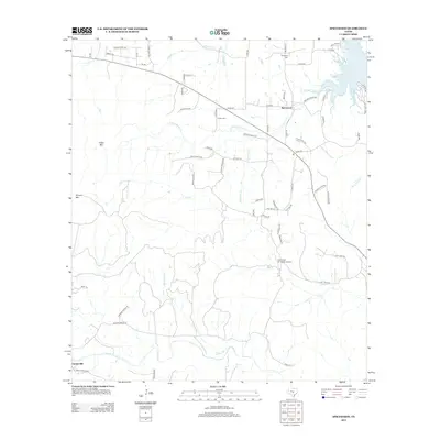
2012 Map of Spicewood
USGS Topo · Published 2012About this map
Spicewood sits at the heart of this Central Texas landscape, where the plateau begins its descent toward the jagged western reaches of Lake Travis. The terrain is defined by prominent elevations such as Cedar Mtn and Shovel Mtn, which overlook a complex network of seasonal drainages including Little Cypress Cr and Fall Cr. This 2012 survey illustrates the modern rural-suburban character of the region, featuring an extensive grid of private ranch roads and newer residential developments like Electric Trl and Granite Ridge Dr. Notable local landmarks include the Fall Creek Air Ranch Airport and long-standing family burial grounds such as Holloway Cem and Fowler Cem. Near the southern edge of the quadrangle, the community of Cypress Mill marks a shift toward the headwaters of Cypress Cr, providing a detailed look at the area's transition from traditional ranching lands to contemporary lakeside estates.
Find a feature on this map
68 named features on this map. Tap any name to fly to it.
Don’t see what you’re looking for? This feature index may not catch every label — zoom into the map to look around manually.
Map Details
Editions of this 2012 Spicewood Map
This is the sole edition of this map. No revisions or reprints were ever made.
Other maps of this area

1887 · Blanco
USGS Topo · 1:125,000

1887 · Burnet
USGS Topo · 1:125,000

1893 · Burnet
USGS Topo · 1:125,000

1894 · Blanco
USGS Topo · 1:125,000

1903 · Burnet
USGS Topo · 1:125,000

1909 · Burnet
USGS Topo · 1:125,000

1925 · Burnet 3-d
USGS Topo · 1:48,000

1929 · Marble Falls
USGS Topo · 1:62,500

1930 · Blanco-1
USGS Topo · 1:48,000

1932 · Marble Falls
USGS Topo · 1:62,500