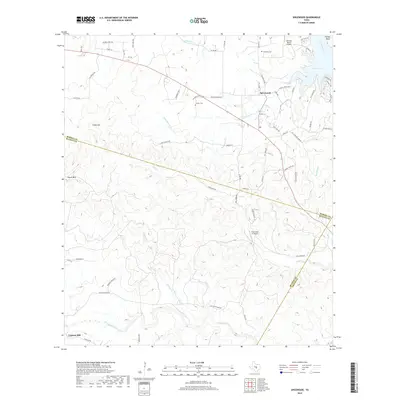
2019 Map of Spicewood
USGS Topo · Published 2019About this map
Spicewood sits at the northern edge of this Central Texas landscape, positioned near the southern inlets of Lake Travis. The terrain here is defined by the significant elevation of Cedar Mtn and Shovel Mtn, with the land dropping toward a complex network of drainages including Little Cypress Cr and Fall Cr. This 2019 survey documents a rural environment increasingly characterized by private ranches and small airstrips like the Fall Creek Air Ranch. To the south, the settlement of Cypress Mill marks the transition into the limestone-cut valleys of the Hill Country. The map tracks the county boundaries where Burnet, Blanco, and Travis counties converge, illustrating how local roads such as Krause Spring Rd and Haynie Flat Rd connect isolated homesteads and riverfront developments like Turkey Bend to the broader regional corridor.
Find a feature on this map
64 named features on this map. Tap any name to fly to it.
Don’t see what you’re looking for? This feature index may not catch every label — zoom into the map to look around manually.
Map Details
Editions of this 2019 Spicewood Map
This is the sole edition of this map. No revisions or reprints were ever made.
Other maps of this area

1887 · Blanco
USGS Topo · 1:125,000

1887 · Burnet
USGS Topo · 1:125,000

1893 · Burnet
USGS Topo · 1:125,000

1894 · Blanco
USGS Topo · 1:125,000

1903 · Burnet
USGS Topo · 1:125,000

1909 · Burnet
USGS Topo · 1:125,000

1925 · Burnet 3-d
USGS Topo · 1:48,000

1929 · Marble Falls
USGS Topo · 1:62,500

1930 · Blanco-1
USGS Topo · 1:48,000

1932 · Marble Falls
USGS Topo · 1:62,500