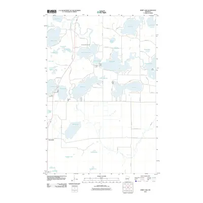
2010 Map of Spirit Lake
USGS Topo · Published 2010About this map
Bennettville sits in a landscape defined by an intricate network of water and wetlands, where the Ripple River connects a chain of glacial lakes. This 2010 survey highlights the region's managed waterways, noted by structures like the Hanging Kettle Lake Dam, Ripple Lake Dam, and Pine Lake Dam. These dams, alongside features like Fire Tower Hill and Hickory Hill, show how the natural topography has been utilized for both resource management and local observation.
Find a feature on this map
70 named features on this map. Tap any name to fly to it.
Don’t see what you’re looking for? This feature index may not catch every label — zoom into the map to look around manually.
Map Details
Editions of this 2010 Spirit Lake Map
This is the sole edition of this map. No revisions or reprints were ever made.
Other maps of this area

1912 · Deerwood
USGS Topo · 1:62,500

1913 · Cuyuna
USGS Topo · 1:62,500

1914 · Deerwood
USGS Topo · 1:62,500

1914 · Aitkin
USGS Topo · 1:62,500

1915 · Aitkin
USGS Topo · 1:62,500

1915 · Cuyuna
USGS Topo · 1:62,500

1916 · Wealthwood
USGS Topo · 1:62,500

1953 · Duluth
USGS Topo · 1:250,000

1958 · Duluth
USGS Topo · 1:250,000

1973 · Iron Hub
USGS Topo · 1:24,000