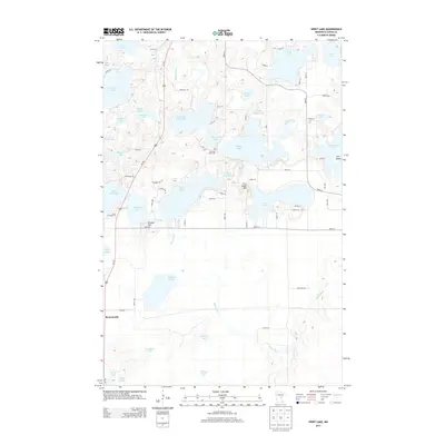
2013 Map of Spirit Lake
USGS Topo · Published 2013About this map
Bennettville serves as the primary settlement hub in this watery landscape of Aitkin County, situated along the Us-169 corridor. The geography is defined by a dense network of glacial lakes and the winding course of the Ripple River, which connects several major water bodies including Hanging Kettle Lake, Diamond Lake, and Ripple Lake. To the east of the river, Fire Tower Hill rises as a notable landmark overlooking Little Turtle Lake, while Hickory Hill stands near the shores of Hickory Lake. Genealogists and local historians will find the Diamond Lake Cem positioned near the center of the quadrangle. The map reveals a mixture of recreational and residential development, evidenced by the Big K Campground and numerous named local roads like Scungwank Rd and Diamond Lake St that provide access to the various shorelines and wooded tracts.
Find a feature on this map
62 named features on this map. Tap any name to fly to it.
Don’t see what you’re looking for? This feature index may not catch every label — zoom into the map to look around manually.
Map Details
Editions of this 2013 Spirit Lake Map
This is the sole edition of this map. No revisions or reprints were ever made.
Other maps of this area

1912 · Deerwood
USGS Topo · 1:62,500

1913 · Cuyuna
USGS Topo · 1:62,500

1914 · Deerwood
USGS Topo · 1:62,500

1914 · Aitkin
USGS Topo · 1:62,500

1915 · Aitkin
USGS Topo · 1:62,500

1915 · Cuyuna
USGS Topo · 1:62,500

1916 · Wealthwood
USGS Topo · 1:62,500

1953 · Duluth
USGS Topo · 1:250,000

1958 · Duluth
USGS Topo · 1:250,000

1973 · Iron Hub
USGS Topo · 1:24,000