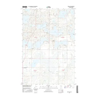
2016 Map of Spirit Lake
USGS Topo · Published 2016About this map
Bennettville sits at the southwestern edge of a landscape defined by an intricate network of glacial lakes and wetlands in Aitkin County. This 2016 survey illustrates the complex hydrology of the region, where the Ripple River meanders through expansive marshes toward the north and east. The map identifies significant local landmarks such as Fire Tower Hill and Hickory Hill, reflecting the elevation changes that overlook the surrounding waters. Genealogy researchers will find the Diamond Lake Cem situated near the shores of Diamond Lake, a central point in a region dotted with family-named water bodies including Edquist Lake, Johnson Lake, and Jacobs Lake. The presence of Elm Island within Elm Island Lake and the dense concentration of township roads like TWP RD 100 reveal a pattern of rural settlement and seasonal recreational use that has shaped this part of Minnesota for generations.
Find a feature on this map
105 named features on this map. Tap any name to fly to it.
Don’t see what you’re looking for? This feature index may not catch every label — zoom into the map to look around manually.
Map Details
Editions of this 2016 Spirit Lake Map
This is the sole edition of this map. No revisions or reprints were ever made.
Other maps of this area

1912 · Deerwood
USGS Topo · 1:62,500

1913 · Cuyuna
USGS Topo · 1:62,500

1914 · Deerwood
USGS Topo · 1:62,500

1914 · Aitkin
USGS Topo · 1:62,500

1915 · Aitkin
USGS Topo · 1:62,500

1915 · Cuyuna
USGS Topo · 1:62,500

1916 · Wealthwood
USGS Topo · 1:62,500

1953 · Duluth
USGS Topo · 1:250,000

1958 · Duluth
USGS Topo · 1:250,000

1973 · Iron Hub
USGS Topo · 1:24,000