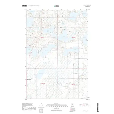
2019 Map of Spirit Lake
USGS Topo · Published 2019About this map
Spirit Lake and its surrounding wetlands dominate this portion of Aitkin County, where the Ripple River winds through a complex system of glacial basins. The settlement of Bennettville sits in the southwestern corner, serving as a landmark near Mallard Lake and Constance Lake. The terrain is characterized by numerous small bodies of water and significant elevation markers like Fire Tower Hill and Hickory Hill, reflecting the post-glacial topography of northern Minnesota. This landscape shows a mix of recreational and rural residential development, with a network of local roads such as Co Hwy 12 and Oak Ave providing access to the shorelines of Lone Lake, Hanging Kettle Lake, and Diamond Lake. Genealogists may find interest in the Diamond Lake Cem, located north of the lake that shares its name, while the presence of named features like Elm Island and Little Turtle Lake highlights the specific local identifiers used by generations of residents.
Find a feature on this map
97 named features on this map. Tap any name to fly to it.
Don’t see what you’re looking for? This feature index may not catch every label — zoom into the map to look around manually.
Map Details
Editions of this 2019 Spirit Lake Map
This is the sole edition of this map. No revisions or reprints were ever made.
Other maps of this area

1912 · Deerwood
USGS Topo · 1:62,500

1913 · Cuyuna
USGS Topo · 1:62,500

1914 · Deerwood
USGS Topo · 1:62,500

1914 · Aitkin
USGS Topo · 1:62,500

1915 · Aitkin
USGS Topo · 1:62,500

1915 · Cuyuna
USGS Topo · 1:62,500

1916 · Wealthwood
USGS Topo · 1:62,500

1953 · Duluth
USGS Topo · 1:250,000

1958 · Duluth
USGS Topo · 1:250,000

1973 · Iron Hub
USGS Topo · 1:24,000