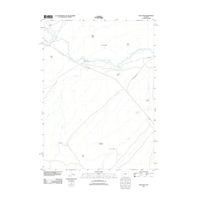
2012 Map of Split Rock
USGS Topo · Published 2012About this map
The Sweetwater River carves through this high plains landscape, following a corridor of immense significance to westward migration. This modern survey documents the intersection of storied pathways, where the Oregon Trl and the California Emigrant Rd traverse the valley. Land use remains dominated by traditional western ranching, evidenced by the McIntosh Ranch, Hat Ranch, and Split Rock Ranch. Distinctive geological landmarks that once guided pioneers are clearly visible, including the iconic granite formation of Split Rock and the Great Stone Face. Water management is critical in this arid environment, marked by the McIntosh Beaton Ditch and Speyers Reservoir. Farther south, the terrain rises toward Telephone Line Ridge and Henry Peak, while smaller homesteads like Speyers Homestead dot the drainages of Willow Cr.
Find a feature on this map
23 named features on this map. Tap any name to fly to it.
Don’t see what you’re looking for? This feature index may not catch every label — zoom into the map to look around manually.
Map Details
Editions of this 2012 Split Rock Map
This is the sole edition of this map. No revisions or reprints were ever made.
Other maps of this area

1951 · Bucklin Reservoirs
USGS Topo · 1:24,000

1951 · Lone Mountain
USGS Topo · 1:24,000

1951 · Black Rock Gap
USGS Topo · 1:24,000

1951 · Split Rock
USGS Topo · 1:24,000

1951 · Split Rock NW
USGS Topo · 1:24,000

1951 · Lankin Dome
USGS Topo · 1:24,000

1955 · Casper
USGS Topo · 1:250,000

1958 · Casper
USGS Topo · 1:250,000

1962 · Casper
USGS Topo · 1:250,000

1962 · Whiskey Peak
USGS Topo · 1:24,000