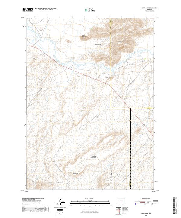
2021 Map of Split Rock
USGS Topo · Published 2021About this map
The Sweetwater River winds through this high-altitude landscape where history is etched into the terrain of the Granite Mountains. This 2021 survey traces the critical corridor of the Oregon Trl and the California Emigrant Rd, pathways that fundamentally shaped the westward expansion of the United States. Distinctive landmarks such as Split Rock and Castle Rock served as vital navigation points for pioneers crossing the high plains. The map reveals the intricate drainage patterns of Lankin Cr and Cottonwood Cr, alongside modern agricultural infrastructure like the McIntosh Beaton Ditch. Remote features like Beaton Pocket and the Great Stone Face suggest a landscape named by those who lived and worked among these granite outcroppings.
Find a feature on this map
27 named features on this map. Tap any name to fly to it.
Don’t see what you’re looking for? This feature index may not catch every label — zoom into the map to look around manually.
Map Details
Editions of this 2021 Split Rock Map
This is the sole edition of this map. No revisions or reprints were ever made.
Other maps of this area

1951 · Bucklin Reservoirs
USGS Topo · 1:24,000

1951 · Lone Mountain
USGS Topo · 1:24,000

1951 · Black Rock Gap
USGS Topo · 1:24,000

1951 · Split Rock
USGS Topo · 1:24,000

1951 · Split Rock NW
USGS Topo · 1:24,000

1951 · Lankin Dome
USGS Topo · 1:24,000

1955 · Casper
USGS Topo · 1:250,000

1958 · Casper
USGS Topo · 1:250,000

1962 · Casper
USGS Topo · 1:250,000

1962 · Whiskey Peak
USGS Topo · 1:24,000