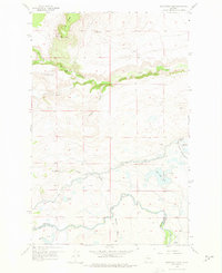
1958 Map of Split Rock Lake
USGS Topo · Published 1975About this map
Sun River flows through this 1950s landscape, marking the transition between the high plains and the foothills of the Front Range. The presence of the Pishkun National Wildlife Refuge and Pishkun Reservoir highlights early water management and conservation efforts in Teton County, supported by the Pishkun Canal and a local aqueduct. Several abandoned homesteads, including Stetler Ranch and Frazier Ranch, point to the shifting patterns of rural settlement during this period.
Find a feature on this map
28 named features on this map. Tap any name to fly to it.
Don’t see what you’re looking for? This feature index may not catch every label — zoom into the map to look around manually.
Map Details
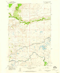
Editions of this 1958 Split Rock Lake Map
2 editions found
Other maps of this area

1903 · Saypo
USGS Topo · 1:125,000

1920 · Choteau
USGS Topo · 1:125,000

1955 · Choteau
USGS Topo · 1:250,000

1957 · Choteau
USGS Topo · 1:250,000

1958 · Choteau
USGS Topo · 1:250,000

1958 · Ear Mountain
USGS Topo · 1:24,000

1958 · Lake Theboe
USGS Topo · 1:24,000

1958 · Barr Creek
USGS Topo · 1:24,000

1958 · Sawtooth Ridge
USGS Topo · 1:24,000

1958 · Castle Reef
USGS Topo · 1:24,000