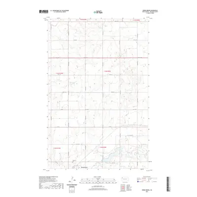
2020 Map of Spring Brook
USGS Topo · Published 2020About this map
Spring Brook anchors the southern portion of this landscape, situated near the winding course of Stony Creek. The town is supported by a network of sectional roads, including 127th Ave NW and 64th St NW, which define the rigid grid of the Public Land Survey System. Cultural landmarks like the Springbrook Cem provide valuable touchpoints for genealogists tracing family roots in this corner of Williams County.
Find a feature on this map
29 named features on this map. Tap any name to fly to it.
Don’t see what you’re looking for? This feature index may not catch every label — zoom into the map to look around manually.
Map Details
Editions of this 2020 Spring Brook Map
This is the sole edition of this map. No revisions or reprints were ever made.
Other maps of this area

1911 · Ray
USGS Topo · 1:125,000

1953 · Williston
USGS Topo · 1:250,000

1957 · Williston
USGS Topo · 1:250,000

1959 · Marmon SE
USGS Topo · 1:24,000

1959 · Williston East
USGS Topo · 1:24,000

1974 · Twin Lakes
USGS Topo · 1:24,000

1978 · Epping NW
USGS Topo · 1:24,000
1978 · Epping NE
USGS Topo · 1:24,000

1978 · Epping
USGS Topo · 1:24,000

1978 · Spring Brook
USGS Topo · 1:24,000