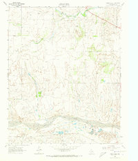
1962 Map of Spring Creek
USGS Topo · Published 1973About this map
The North Fork Red River dominates the southern reaches of this landscape, its wide, braided bed carving through the Panhandle terrain near the Wheeler and Gray county line. Surveyed in the early 1960s, the map reveals a region defined by energy extraction and transport, evidenced by the extensive Gas and Oil Field and numerous Oil Wells peppered across the rolling plains. The Fort Worth and Denver railway runs parallel to the river, serving as a critical artery for the area's industrial output. Water sources like Sweetwater Creek, Graham Creek, and Spring Creek wind across the northern half of the quadrangle, providing drainage for the ranchlands and industrial sites alike. This document captures the infrastructure of the Texas Panhandle during a period of significant petroleum activity, marked by various Pipeline networks and active Gravel Pits.
Find a feature on this map
15 named features on this map. Tap any name to fly to it.
Don’t see what you’re looking for? This feature index may not catch every label — zoom into the map to look around manually.
Map Details
Editions of this 1962 Spring Creek Map
2 editions found
Other maps of this area

1954 · Amarillo
USGS Topo · 1:250,000

1958 · Amarillo
USGS Topo · 1:250,000

1962 · Back
USGS Topo · 1:24,000

1962 · Pond Creek
USGS Topo · 1:24,000

1962 · Wheeler
USGS Topo · 1:24,000

1962 · Spring Creek
USGS Topo · 1:24,000

1962 · Wheeler SE
USGS Topo · 1:24,000

1962 · Pakan
USGS Topo · 1:24,000

1963 · Briscoe
USGS Topo · 1:24,000

1963 · Mobeetie
USGS Topo · 1:24,000