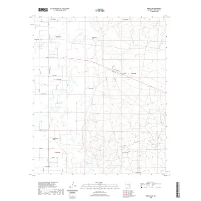
2020 Map of Spring Lake
USGS Topo · Published 2020About this map
The eastern edges of Artesia meet the wandering course of the Pecos River in this 2020 landscape. This area of Eddy County is defined by its drainage patterns, where numerous seasonal watercourses like Dog Canyon Draw, Hart Canyon, and Logan Draw feed into the river valley from the surrounding heights. To the south, Spring Lake and Tumbleweed Draw indicate a low-lying riparian environment that has long influenced the local settlement pattern. Beyond the irrigated fields near the river, the map documents an extensive network of rural roads such as Chalk Bluff Rd and Empire Rd that serve the outlying ranching and industrial lands. The small community of Riverside sits east of the river along the highway, illustrating the secondary clusters of development that followed the established transport corridors through the Pecos valley.
Find a feature on this map
44 named features on this map. Tap any name to fly to it.
Don’t see what you’re looking for? This feature index may not catch every label — zoom into the map to look around manually.
Map Details
Editions of this 2020 Spring Lake Map
This is the sole edition of this map. No revisions or reprints were ever made.
Other maps of this area

1943 · Oil City
USGS Topo · 1:62,500

1951 · Diamond Mound
USGS Topo · 1:24,000

1953 · Espuela
USGS Topo · 1:24,000

1954 · Carlsbad
USGS Topo · 1:250,000

1955 · Artesia
USGS Topo · 1:24,000

1955 · Artesia NE
USGS Topo · 1:24,000

1955 · Spring Lake
USGS Topo · 1:24,000

1955 · Dayton
USGS Topo · 1:24,000

1955 · Lake Mc Millan North
USGS Topo · 1:24,000

1955 · Red Lake
USGS Topo · 1:24,000