
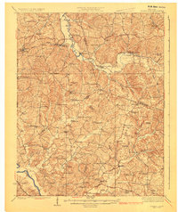
1925 Map of Spring Lick
USGS Topo · Published 1925About this map
The Green River curves through the southwestern corner of this region, anchoring a landscape defined by small agricultural settlements and a dense network of one-room schoolhouses. Located at the intersection of Ohio, Grayson, and Butler counties, the area reveals a rural society structured around local crossroads. Numerous family-named landmarks and institutions like Flener Chapel and Mt Pleasant Church appear alongside community hubs such as Rosine and Horse Branch.
Find a feature on this map
89 named features on this map. Tap any name to fly to it.
Don’t see what you’re looking for? This feature index may not catch every label — zoom into the map to look around manually.
Map Details
Editions of this 1925 Spring Lick Map
2 editions found
Other maps of this area

1907 · Whitesville
USGS Topo · 1:62,500

1909 · Whitesville
USGS Topo · 1:62,500

1909 · Hartford
USGS Topo · 1:62,500

1911 · Dunmor
USGS Topo · 1:48,000

1914 · Little Muddy
USGS Topo · 1:62,500

1914 · Dunmor
USGS Topo · 1:62,500

1922 · Leitchfield
USGS Topo · 1:48,000

1922 · Brownsville
USGS Topo · 1:62,500

1923 · Brownsville
USGS Topo · 1:62,500

1925 · Leitchfield
USGS Topo · 1:62,500