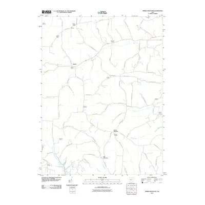
2010 Map of Spring Mountain
USGS Topo · Published 2010About this map
Spring Mountain and Stillwell anchor this rural landscape in western Coshocton County, defined by a network of winding township roads and quiet stream valleys. The map reveals a high concentration of burial grounds, providing significant data for genealogists tracing families at Barnes Cemetery, Stillwell Cemetery, and Dutch Run Cemetery. The intriguing label for Fort Fizzle in the northwest corner points to a unique local landmark, while settlements like New Princeton and French Ridge are situated among the headwaters of Beaver Run and Hoagland Run. This 2010 survey by the U.S. Geological Survey illustrates the enduring rural character of the region, where numerous named runs like Lepley Run and Darling Run carve through the terrain between small community clusters and family cemeteries.
Find a feature on this map
69 named features on this map. Tap any name to fly to it.
Don’t see what you’re looking for? This feature index may not catch every label — zoom into the map to look around manually.
Map Details
Editions of this 2010 Spring Mountain Map
This is the sole edition of this map. No revisions or reprints were ever made.
Other maps of this area

1912 · Loudonville
USGS Topo · 1:62,500

1913 · Brinkhaven
USGS Topo · 1:62,500

1913 · Coshocton
USGS Topo · 1:62,500

1914 · Loudonville
USGS Topo · 1:62,500

1915 · Brinkhaven
USGS Topo · 1:62,500

1915 · Millersburg
USGS Topo · 1:62,500

1915 · Coshocton
USGS Topo · 1:62,500

1943 · Millersburg
USGS Topo · 1:62,500

1943 · Coshocton
USGS Topo · 1:62,500

1943 · Loudonville
USGS Topo · 1:62,500