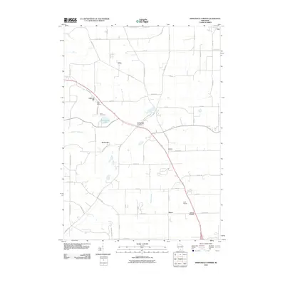
2010 Map of Springfield Corners
USGS Topo · Published 2010About this map
Springfield Corners and its neighboring hamlets sit at the heart of this rural Dane County survey, showcasing a landscape of established family farms and early 21st-century conservation efforts. The area is defined by its small crossroads settlements, including Martinsville and Ashton, which are connected by a network of historic routes like County Hwy-V and Lodi Springfield Rd. This region preserves its local heritage through sites like Saint Johns Cemetery and Roxbury Cemetery, while Lutheran Hill provides a distinct landmark against the rolling terrain. Local recreation and geography are anchored by Camp Brandenburg and the waters of Brandenburg Lake. The mapping of drainage systems such as Halfway Prairie Creek and Pheasant Branch reveals the foundational role of water management in sustaining these agricultural communities.
Find a feature on this map
58 named features on this map. Tap any name to fly to it.
Don’t see what you’re looking for? This feature index may not catch every label — zoom into the map to look around manually.
Map Details
Editions of this 2010 Springfield Corners Map
This is the sole edition of this map. No revisions or reprints were ever made.
Other maps of this area

1890 · Madison
USGS Topo · 1:62,500

1892 · Madison
USGS Topo · 1:62,500

1895 · Baraboo
USGS Topo · 1:62,500

1901 · Poynette
USGS Topo · 1:62,500

1904 · Madison
USGS Topo · 1:62,500

1906 · Madison
USGS Topo · 1:62,500

1907 · Cross Plains
USGS Topo · 1:62,500

1908 · Baraboo
USGS Topo · 1:62,500

1909 · Cross Plains
USGS Topo · 1:62,500

1957 · Madison
USGS Topo · 1:250,000