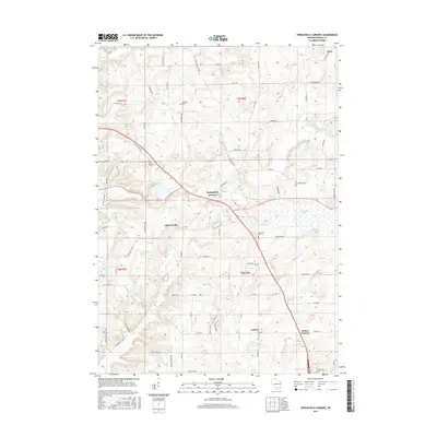
2016 Map of Springfield Corners
USGS Topo · Published 2016About this map
Springfield Corners serves as a central hub for this portion of Dane County, where a network of agricultural roads connects small crossroads communities. This landscape is defined by its glacial heritage, featuring the Waunakee Marsh to the east and the kettle-like Brandenburg Lake near Martinsville. Local heritage is anchored by significant sites such as Saint Johns Cem and the Roxbury Cem, which mark the presence of long-established families and parish life in the rural Midwest.
Find a feature on this map
72 named features on this map. Tap any name to fly to it.
Don’t see what you’re looking for? This feature index may not catch every label — zoom into the map to look around manually.
Map Details
Editions of this 2016 Springfield Corners Map
This is the sole edition of this map. No revisions or reprints were ever made.
Other maps of this area

1890 · Madison
USGS Topo · 1:62,500

1892 · Madison
USGS Topo · 1:62,500

1895 · Baraboo
USGS Topo · 1:62,500

1901 · Poynette
USGS Topo · 1:62,500

1904 · Madison
USGS Topo · 1:62,500

1906 · Madison
USGS Topo · 1:62,500

1907 · Cross Plains
USGS Topo · 1:62,500

1908 · Baraboo
USGS Topo · 1:62,500

1909 · Cross Plains
USGS Topo · 1:62,500

1957 · Madison
USGS Topo · 1:250,000