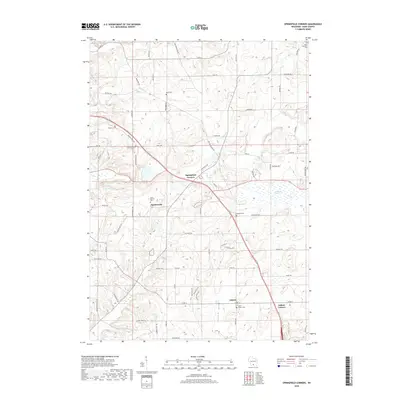
2018 Map of Springfield Corners
USGS Topo · Published 2018About this map
The agrarian landscape of Dane County is anchored by the rural crossroads of Springfield Corners and Martinsville, where historic community markers like Saint Martin's Cem and Saint John's Lutheran Cem reflect generations of local settlement. To the east, the sprawling Waunakee Marsh dominates the lowlands, providing a natural contrast to the grid of family-named farm roads such as Lodi Springfield Rd and Ballweg Rd. The southern portion of the area features the village of Ashton and its nearby namesake, Ashton Corners, while local drainage is defined by the winding paths of Halfway Prairie Cr and Pheasant Br. This 2018 survey reveals a territory where modern development increasingly meets established agricultural heritage and numerous small burial grounds, including the Kohlman Cem and Truehl Cem.
Find a feature on this map
72 named features on this map. Tap any name to fly to it.
Don’t see what you’re looking for? This feature index may not catch every label — zoom into the map to look around manually.
Map Details
Editions of this 2018 Springfield Corners Map
This is the sole edition of this map. No revisions or reprints were ever made.
Other maps of this area

1890 · Madison
USGS Topo · 1:62,500

1892 · Madison
USGS Topo · 1:62,500

1895 · Baraboo
USGS Topo · 1:62,500

1901 · Poynette
USGS Topo · 1:62,500

1904 · Madison
USGS Topo · 1:62,500

1906 · Madison
USGS Topo · 1:62,500

1907 · Cross Plains
USGS Topo · 1:62,500

1908 · Baraboo
USGS Topo · 1:62,500

1909 · Cross Plains
USGS Topo · 1:62,500

1957 · Madison
USGS Topo · 1:250,000