
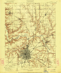
1907 Map of Springfield
USGS Topo · Published 1907About this map
Springfield dominates this central Illinois landscape as a burgeoning capital city at the turn of the century, characterized by its dense grid and radiating network of rail and electric lines. The Illinois Traction System and numerous railroads like the Chicago and Alton RR converge on the city, illustrating its role as a vital transportation hub. Beyond the urban center, the map reveals key cultural and civic sites including the State Fair Grounds, the military encampment at Camp Lincoln, and the Reservoir.
Find a feature on this map
68 named features on this map. Tap any name to fly to it.
Don’t see what you’re looking for? This feature index may not catch every label — zoom into the map to look around manually.
Map Details
Editions of this 1907 Springfield Map
2 editions found
Other maps of this area

1909 · Tallula
USGS Topo · 1:62,500

1911 · Lincoln
USGS Topo · 1:62,500

1913 · Lincoln
USGS Topo · 1:62,500

1922 · Divernon
USGS Topo · 1:62,500

1923 · Taylorville
USGS Topo · 1:62,500

1924 · Divernon
USGS Topo · 1:62,500

1924 · Waverly
USGS Topo · 1:62,500

1925 · Taylorville
USGS Topo · 1:62,500

1926 · Waverly
USGS Topo · 1:62,500

1930 · Springfield
USGS Topo · 1:62,500