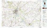
1985 Map of Springfield
USGS Topo · Published 1990About this map
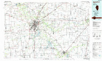
Springfield serves as the focal point of this Central Illinois region in the mid-1980s, where the convergence of the Sangamon River and several major transportation corridors highlights the city's role as a political and logistical hub. The map detail reveals the urban expansion around Lake Springfield and the dense concentration of civic sites, including the State Capitol and the Lincoln Home National Historic Site. To the east, Decatur anchors the edge of the sheet near Lake Decatur, while smaller agricultural settlements like Chatham, Auburn, and Rochester are connected by a network of railroads including the Illinois Central Gulf RR and the Norfolk and Western Ry.
Find a feature on this map
215 named features on this map. Tap any name to fly to it.
Don’t see what you’re looking for? This feature index may not catch every label — zoom into the map to look around manually.
Map Details
Editions of this 1985 Springfield Map
2 editions found
Other maps of this area

1907 · Springfield
USGS Topo · 1:62,500

1909 · Tallula
USGS Topo · 1:62,500

1911 · Lincoln
USGS Topo · 1:62,500

1913 · Lincoln
USGS Topo · 1:62,500

1922 · Divernon
USGS Topo · 1:62,500

1923 · Carlinville
USGS Topo · 1:48,000

1923 · Taylorville
USGS Topo · 1:62,500

1923 · Raymond
USGS Topo · 1:62,500

1924 · Divernon
USGS Topo · 1:62,500

1924 · Waverly
USGS Topo · 1:62,500