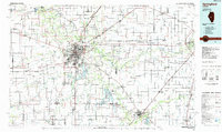
1985 Map of Springfield
USGS Topo · Published 1985About this map
The Sangamon River valley and its surrounding central Illinois prairie were undergoing significant suburban and infrastructure development by the mid-1980s. This planimetric study documents the expansion of Springfield toward the southeast, where Lake Springfield and Sangchris Lake serve as major hydrological and recreational hubs. The map highlights the region's deep connection to Abraham Lincoln through the preservation of the Lincoln Home Nat Hist Site and Lincoln's New Salem State Park near Petersburg. Transportation networks dominate the landscape, with the Illinois Central Gulf and Norfolk and Western railroads intersecting the grid of U.S. 66 and newer state routes. The presence of Sangamon State Univ and Lincoln Land Jr College reflects the area's growth as an educational center, while industrial roots remain visible in settlements like Decatur and Illiopolis.
Find a feature on this map
113 named features on this map. Tap any name to fly to it.
Don’t see what you’re looking for? This feature index may not catch every label — zoom into the map to look around manually.
Map Details
Editions of this 1985 Springfield Map
2 editions found
Other maps of this area

1907 · Springfield
USGS Topo · 1:62,500

1909 · Tallula
USGS Topo · 1:62,500

1911 · Lincoln
USGS Topo · 1:62,500

1913 · Lincoln
USGS Topo · 1:62,500

1922 · Divernon
USGS Topo · 1:62,500

1923 · Carlinville
USGS Topo · 1:48,000

1923 · Taylorville
USGS Topo · 1:62,500

1923 · Raymond
USGS Topo · 1:62,500

1924 · Divernon
USGS Topo · 1:62,500

1924 · Waverly
USGS Topo · 1:62,500