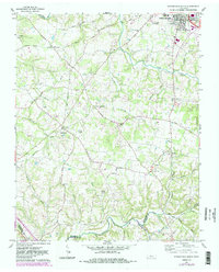
1961 Map of Springfield South
USGS Topo · Published 1983About this map
The southern outskirts of Springfield and the rolling hills of Robertson County define this early 1960s landscape, just before significant suburban expansion. Small agricultural hubs like Coopertown and Flewellyn are centered around local institutions such as the Flewellyn School and numerous country churches. The map reveals a high density of family and community burial grounds, including the Lipscomb Cem, Murphy Cem, and the Cem Frierson Chapel, which serve as vital markers for local genealogists. The terrain is deeply etched by a network of waterways including Carr Creek, Browns Fork, and the winding Sycamore Creek near the southern border with Cheatham County. Notable landmarks such as the County Farm and the Radio Tower (WDBL) indicate the administrative and technological presence in the county at mid-century.
Find a feature on this map
59 named features on this map. Tap any name to fly to it.
Don’t see what you’re looking for? This feature index may not catch every label — zoom into the map to look around manually.
Map Details
Editions of this 1961 Springfield South Map
4 editions found
Other maps of this area

1903 · Nashville
USGS Topo · 1:125,000

1931 · Ridgetop
USGS Topo · 1:62,500

1935 · Ridgetop
USGS Topo · 1:62,500

1952 · Springfield North
USGS Topo · 1:24,000

1952 · Youngville
USGS Topo · 1:24,000

1955 · Whites Creek
USGS Topo · 1:24,000

1955 · Forest Grove
USGS Topo · 1:24,000

1956 · Nashville
USGS Topo · 1:250,000

1957 · Adams
USGS Topo · 1:24,000

1957 · Pleasant View
USGS Topo · 1:24,000