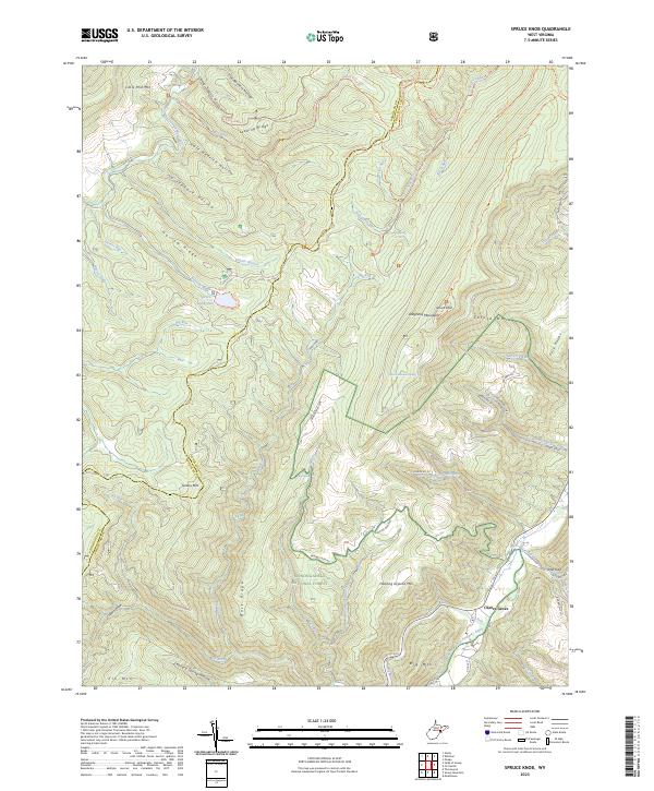
2023 Map of Spruce Knob
USGS Topo · Published 2023About this map
Cherry Grove sits at the foot of the Allegheny Mountains, serving as a focal point for the headwaters of the North Fork South Branch Potomac River. This area of the Monongahela National Forest is defined by its high-altitude ridges and numerous drainage systems, including Seneca Creek and Gandy Creek. Local geography is marked by the presence of Spruce Knob Lake and Spruce Knob, while more secluded sites like Judy Spring and Spruce Mountain Spring indicate the region's diverse hydrography. The map details an intricate network of forest roads and hiking paths, such as the Huckleberry Trl and Lumberjack Trl, which navigate the terrain between Narrow Ridge and the Fore Knobs. Named hollows and ridges like Camp Seven Hollow and Leading Ridge provide specific landmarks for researchers of this highland landscape.
Find a feature on this map
68 named features on this map. Tap any name to fly to it.
Don’t see what you’re looking for? This feature index may not catch every label — zoom into the map to look around manually.
Map Details
Editions of this 2023 Spruce Knob Map
This is the sole edition of this map. No revisions or reprints were ever made.
Other maps of this area

1889 · Beverly
USGS Topo · 1:125,000

1892 · Beverly
USGS Topo · 1:125,000

1892 · Franklin
USGS Topo · 1:125,000

1896 · Franklin
USGS Topo · 1:125,000

1920 · Onego
USGS Topo · 1:62,500

1921 · Onego
USGS Topo · 1:48,000

1922 · Onego
USGS Topo · 1:62,500

1922 · Horton
USGS Topo · 1:48,000

1922 · Spruce Knob
USGS Topo · 1:48,000

1922 · Circleville
USGS Topo · 1:62,500