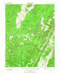
1922 Map of Spruce Knob
USGS Topo · Published 1965About this map
Spruce Knob rises as the dominant height in this survey of the Allegheny Mountains, anchoring a landscape where the Monongahela National Forest and George Washington National Forest converge. The mapping captures a network of high-altitude agricultural and timber-linked communities across the West Virginia and Virginia border. Small pockets of life are centered around one-room schoolhouses like the Blister Swamp School, Stark School, and Allegheny School, while the presence of the Osceola P O and Thornwood P O indicates the importance of the postal service in these isolated hollows. Notable geographic features include the subterranean drainage pattern of The Sinks on Gandy Creek and the sharp linear ridge of Devil Backbone. Transport is defined by the Winterburn Sta and the winding course of the Dry Fork and Laurel Fork rivers, which carved the passes used by early travelers through the North Fork Mtn range.
Find a feature on this map
119 named features on this map. Tap any name to fly to it.
Don’t see what you’re looking for? This feature index may not catch every label — zoom into the map to look around manually.
Map Details
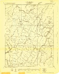
Editions of this 1922 Spruce Knob Map
3 editions found

Other maps of this area

1889 · Beverly
USGS Topo · 1:125,000

1892 · Beverly
USGS Topo · 1:125,000

1892 · Franklin
USGS Topo · 1:125,000

1894 · Staunton
USGS Topo · 1:125,000

1896 · Franklin
USGS Topo · 1:125,000

1901 · Monterey
USGS Topo · 1:125,000

1909 · Elkins
USGS Topo · 1:62,500

1920 · Onego
USGS Topo · 1:62,500

1921 · Onego
USGS Topo · 1:48,000

1922 · Onego
USGS Topo · 1:62,500