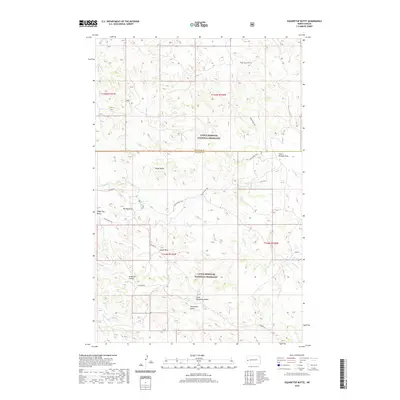
2020 Map of Squaretop Butte
USGS Topo · Published 2020About this map
Little Missouri National Grassland encompasses this high-plains landscape where McKenzie and Billings counties meet. The topography is defined by dramatic elevations and isolated peaks, including Squaretop Butte, Little Squaretop Butte, and the prominent Big Top Mesa. These features are connected by the Maah Daah Hey trail, which winds through the complex drainage systems of Sand Creek and Magpie Creek. The presence of landmarks like Ice Caves and Scairt Woman Draw indicates a varied and specialized terrain typical of the western North Dakota badlands. This modern survey illustrates the current management of public lands, highlighting how natural formations like Tower Butte and Castel Rock serve as key navigational points within the grassland's expansive network of coulees and draws.
Find a feature on this map
21 named features on this map. Tap any name to fly to it.
Don’t see what you’re looking for? This feature index may not catch every label — zoom into the map to look around manually.
Map Details
Editions of this 2020 Squaretop Butte Map
This is the sole edition of this map. No revisions or reprints were ever made.
Other maps of this area

1953 · Watford City
USGS Topo · 1:250,000

1957 · Watford City
USGS Topo · 1:250,000

1963 · Gorham NW
USGS Topo · 1:24,000

1963 · Gorham
USGS Topo · 1:24,000

1967 · Watford City
USGS Topo · 1:250,000

1970 · Hanks Gully
USGS Topo · 1:24,000

1970 · Roosevelt Creek East
USGS Topo · 1:24,000

1974 · Wolf Coulee
USGS Topo · 1:24,000

1974 · Squaretop Butte
USGS Topo · 1:24,000

1974 · Buckskin Butte
USGS Topo · 1:24,000