
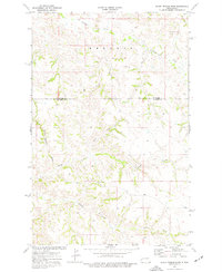
1974 Map of Squaretop Butte
USGS Topo · Published 1977About this map
Squaretop Butte and its neighbor Little Squaretop Butte rise above a deeply eroded badlands landscape in this mid-1970s survey. The map details the complex drainage systems that define the area, showing how the headwaters of Magpie Creek and Whitetail Creek cut through the high plains near the border of McKenzie and Billings counties. In the northern reaches, the Sand Creek drainage is overlooked by Rhoades, while prominent landmarks like Tower Butte and Cedar Top Butte provide distinct vertical relief in the central and western sections. The terrain is marked by a network of unimproved roads and cattle guards, reflecting the ranching character of this part of North Dakota. For the researcher, the map captures the precise location of ranch buildings and water features such as Anderson Coulee and North Creek at a time of relatively sparse human development.
Find a feature on this map
11 named features on this map. Tap any name to fly to it.
Don’t see what you’re looking for? This feature index may not catch every label — zoom into the map to look around manually.
Map Details
Editions of this 1974 Squaretop Butte Map
This is the sole edition of this map. No revisions or reprints were ever made.
Other maps of this area

1953 · Watford City
USGS Topo · 1:250,000

1957 · Watford City
USGS Topo · 1:250,000

1963 · Gorham NW
USGS Topo · 1:24,000

1963 · Gorham
USGS Topo · 1:24,000

1967 · Watford City
USGS Topo · 1:250,000

1970 · Hanks Gully
USGS Topo · 1:24,000

1970 · Roosevelt Creek East
USGS Topo · 1:24,000

1974 · Wolf Coulee
USGS Topo · 1:24,000

1974 · Buckskin Butte
USGS Topo · 1:24,000
1974 · Scairt Woman Draw
USGS Topo · 1:24,000