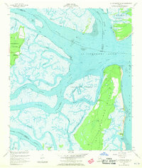
1954 Map of St Catherines Sound
USGS Topo · Published 1970About this map
St Catherines Island and its surrounding marshlands dominate this mid-century coastal survey, illustrating the complex hydrology of the Georgia Sea Islands. The landscape is defined by the intricate winding of the Medway River and Timmons River, which feed into the expansive St Catherines Sound. Coastal activity centers on small outposts like the Yellow Bluff Fishing Camp on Colonels Island and the isolated Youmans Landing Field. This era of the map captures the transition of the Intracoastal Waterway, including an alternate route threading through Walburg Creek. The presence of several Artesian Wells across the interior of the islands points to the historical importance of securing freshwater sources in this brackish environment. Further south, the map details the terrain of Walburg Island and the smaller Black Hammock and McQueen Hammock landforms before reaching the Atlantic Ocean.
Find a feature on this map
41 named features on this map. Tap any name to fly to it.
Don’t see what you’re looking for? This feature index may not catch every label — zoom into the map to look around manually.
Map Details
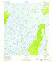
Editions of this 1954 St Catherines Sound Map
2 editions found
Other maps of this area

1920 · Sapelo River
USGS Topo · 1:62,500

1920 · Limerick
USGS Topo · 1:62,500

1928 · St Catherines Island
USGS Topo · 1:62,500

1943 · St Catherines Island
USGS Topo · 1:62,500

1943 · Sapelo River
USGS Topo · 1:62,500

1944 · Limerick
USGS Topo · 1:62,500

1944 · Ossabaw Island
USGS Topo · 1:62,500

1945 · St. Catherine's Island
USGS Topo · 1:62,500

1945 · Ossabaw Island
USGS Topo · 1:62,500

1945 · Sapelo River
USGS Topo · 1:62,500