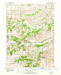
1951 Map of St. Charles
USGS Topo · Published 1964About this map
The rolling hills of Madison Co and Warren Co are defined by a complex network of river valleys and the infrastructure of early 20th-century agriculture. Middle River, North River, and Clanton Creek carve through the landscape, their crossings marked by notable spans like Imes Bridge and Hollowell Bridge. This era shows the rural community structure at its peak, with numerous numbered schoolhouses such as School No 3 and School No 2 serving dispersed farmsteads between the established rail towns.
Find a feature on this map
58 named features on this map. Tap any name to fly to it.
Don’t see what you’re looking for? This feature index may not catch every label — zoom into the map to look around manually.
Map Details
Editions of this 1951 St. Charles Map
2 editions found
Other maps of this area

1905 · Des Moines
USGS Topo · 1:62,500

1907 · Des Moines
USGS Topo · 1:62,500

1908 · Waukee
USGS Topo · 1:62,500

1931 · Indianola
USGS Topo · 1:62,500

1949 · Adel
USGS Topo · 1:62,500

1950 · New Virginia
USGS Topo · 1:62,500

1951 · Adel
USGS Topo · 1:62,500

1951 · Osceola
USGS Topo · 1:62,500

1951 · St. Charles
USGS Topo · 1:62,500

1951 · Afton
USGS Topo · 1:62,500