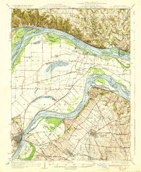
1933 Map of St. Charles
USGS Topo · Published 1933About this map
The confluence of the Mississippi River and Missouri River dominates this landscape, where the shifting waters have carved out complex islands and chutes. Between the two great rivers lies the fertile bottomland of St. Charles Co, marked by a grid of rural schools and small rail-side settlements such as Orchard Farm and Portage Des Sioux. The Missouri shore is guarded by the National Guard Target Range, while the Illinois side features steep bluffs rising above Elsah and Chautauqua.
Find a feature on this map
95 named features on this map. Tap any name to fly to it.
Don’t see what you’re looking for? This feature index may not catch every label — zoom into the map to look around manually.
Map Details
Editions of this 1933 St. Charles Map
3 editions found

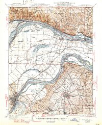
Other maps of this area

1888 · St. Louis
USGS Topo · 1:62,500

1903 · O'Fallon
USGS Topo · 1:125,000

1924 · Robertson
USGS Topo · 1:24,000

1925 · Brighton
USGS Topo · 1:62,500

1927 · Alton
USGS Topo · 1:62,500

1927 · St. Charles
USGS Topo · 1:62,500

1928 · Brighton
USGS Topo · 1:62,500

1930 · Hardin
USGS Topo · 1:62,500

1930 · Jerseyville
USGS Topo · 1:62,500

1931 · Brussels
USGS Topo · 1:62,500