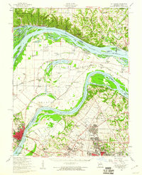
1954 Map of St. Charles
USGS Topo · Published 1960About this map
Pere Marquette State Park and the bluffs of the Mississippi River dominate the northern landscape of this mid-century survey, where the river serves as both a natural boundary and a commercial artery. The terrain transitions from the rugged hollows like Jerseyville Hollow and Distillery Hollow in Illinois to the fertile, low-lying bottomlands of Missouri. Significant early aviation history is evident with the sprawling Lambert St Louis Airport and smaller fields like Smartt Airfield and the St Charles Airport, signaling the region's post-war industrial expansion. Urban development is concentrated in Florissant and Ferguson, while older religious and educational institutions like Principia College and the St Stanislaus Seminary Cem remain prominent landmarks. The intricate network of islands and sloughs, including Mason Island and Portage Island, illustrates the complex hydrologic character of the river junction.
Find a feature on this map
129 named features on this map. Tap any name to fly to it.
Don’t see what you’re looking for? This feature index may not catch every label — zoom into the map to look around manually.
Map Details
Editions of this 1954 St. Charles Map
2 editions found
Other maps of this area

1888 · St. Louis
USGS Topo · 1:62,500

1903 · O'Fallon
USGS Topo · 1:125,000

1924 · Robertson
USGS Topo · 1:24,000

1925 · Brighton
USGS Topo · 1:62,500

1927 · Alton
USGS Topo · 1:62,500

1927 · St. Charles
USGS Topo · 1:62,500

1928 · Brighton
USGS Topo · 1:62,500

1930 · Hardin
USGS Topo · 1:62,500

1930 · Jerseyville
USGS Topo · 1:62,500

1931 · Brussels
USGS Topo · 1:62,500