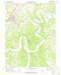
1969 Map of St. Clair
USGS Topo · Published 1971About this map
The St Louis-San Francisco railroad and the Fifth Principal Meridian anchor this survey of the northern Ozark borderlands. The city of St Clair dominates the northwest corner, showing its mid-century growth through the St Clair Municipal Airport, residential areas like Parkway, and early infrastructure. South of the city, the landscape shifts to the dramatic meanders of the Meramec River, which carves through the rugged limestone terrain between Central and Prairie townships.
Find a feature on this map
29 named features on this map. Tap any name to fly to it.
Don’t see what you’re looking for? This feature index may not catch every label — zoom into the map to look around manually.
Map Details
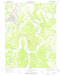
Editions of this 1969 St. Clair Map
2 editions found
Other maps of this area

1901 · De Soto
USGS Topo · 1:125,000

1903 · Sullivan
USGS Topo · 1:125,000

1934 · Meramec State Park
USGS Topo · 1:24,000

1937 · Meramec State Park
USGS Topo · 1:24,000

1946 · Richwoods
USGS Topo · 1:62,500

1946 · Union
USGS Topo · 1:62,500

1947 · Sullivan
USGS Topo · 1:62,500

1947 · St. Clair
USGS Topo · 1:62,500

1948 · Richwoods
USGS Topo · 1:62,500

1948 · Union
USGS Topo · 1:62,500