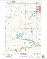
1970 Map of St James West
USGS Topo · Published 1979About this map
The Chicago and North Western railway anchors the regional economy in this portion of Watonwan County, connecting the growing hub of St James to the surrounding agricultural prairie. At the town's edge, St James Lake and Memorial Park provide community spaces, while the surrounding landscape is dotted with small-town nodes like Echols and rural congregations including Kansas Lake Ch and Long Lake Ch.
Find a feature on this map
27 named features on this map. Tap any name to fly to it.
Don’t see what you’re looking for? This feature index may not catch every label — zoom into the map to look around manually.
Map Details
Editions of this 1970 St James West Map
2 editions found
Other maps of this area

1953 · New Ulm
USGS Topo · 1:250,000

1954 · Fairmont
USGS Topo · 1:250,000

1957 · New Ulm
USGS Topo · 1:250,000

1958 · New Ulm
USGS Topo · 1:250,000

1958 · Fairmont
USGS Topo · 1:250,000

1967 · New Ulm
USGS Topo · 1:250,000

1967 · Godahl
USGS Topo · 1:24,000

1967 · Darfur
USGS Topo · 1:24,000
1967 · La Salle
USGS Topo · 1:24,000

1970 · St James SE
USGS Topo · 1:24,000