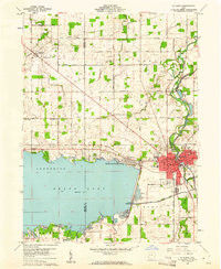
1960 Map of St. Marys
USGS Topo · Published 1961About this map
Grand Lake and the St Marys River define the landscape of this 1960 survey, illustrating a region shaped by both recreational development and 19th-century infrastructure. The city of St Marys serves as the focal point, where the Miami and Erie Canal (Abandoned) still marks its historic route through the town center, crossing over an Aqueduct and passing by Forty Acre Pond. The era's local culture is visible in features like the New York Drive-in Theater and Armstrong Park, while the rural surroundings of Center Noble and Jefferson townships are dotted with oil and gas wells, signifying the persistent extraction economy of western Ohio.
Find a feature on this map
68 named features on this map. Tap any name to fly to it.
Don’t see what you’re looking for? This feature index may not catch every label — zoom into the map to look around manually.
Map Details
Editions of this 1960 St. Marys Map
3 editions found
Other maps of this area

1908 · St. Henry
USGS Topo · 1:62,500

1909 · Loramie
USGS Topo · 1:62,500

1911 · Loramie
USGS Topo · 1:62,500

1911 · Spencerville
USGS Topo · 1:62,500

1914 · Celina
USGS Topo · 1:62,500

1944 · Loramie
USGS Topo · 1:62,500

1944 · Celina
USGS Topo · 1:62,500

1944 · Spencerville
USGS Topo · 1:62,500

1953 · Muncie
USGS Topo · 1:250,000

1956 · Muncie
USGS Topo · 1:250,000