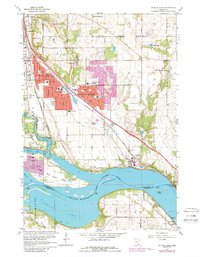
1967 Map of St. Paul Park
USGS Topo · Published 1989About this map
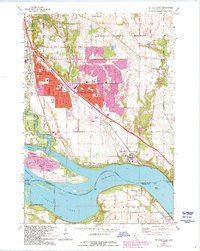
Industrial and residential development defines this riverfront corridor where St Paul Park and Cottage Grove meet the eastern banks of the Mississippi River. The landscape reflects a mid-century period of expansion, visible in the dense clusters of schools like Park High Sch and Pullman Sch, alongside critical infrastructure such as the St Paul-Park Airport and extensive stockyards. The river itself is dominated by the large landmass of Grey Cloud Island, separated from the mainland by the Grey Cloud Channel and Mooers Lake.
Find a feature on this map
55 named features on this map. Tap any name to fly to it.
Don’t see what you’re looking for? This feature index may not catch every label — zoom into the map to look around manually.
Map Details
Editions of this 1967 St. Paul Park Map
5 editions found
Other maps of this area

1896 · St. Paul
USGS Topo · 1:62,500

1946 · Hudson
USGS Topo · 1:62,500

1949 · Hudson
USGS Topo · 1:62,500

1949 · Lake Elmo
USGS Topo · 1:24,000

1949 · Hudson
USGS Topo · 1:24,000

1950 · Lake Elmo
USGS Topo · 1:24,000

1950 · Hudson
USGS Topo · 1:24,000

1950 · St Paul Park
USGS Topo · 1:24,000

1951 · St Paul Park
USGS Topo · 1:24,000

1951 · Prescott
USGS Topo · 1:24,000