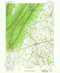
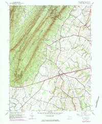
1944 Map of St Thomas
USGS Topo · Published 1969About this map
Kittatinny Mountain and Broad Mountain dominate the northwestern landscape of this Franklin County region, separated by the narrow McCasslin Valley. This 1944 survey, updated with 1968 aerial revisions, shows the rural character of the Cumberland Valley before significant modern development. The community of St Thomas sits along Route 30, while smaller historical nodes like Franklin Furnace and Edenville flank the eastern slopes of the ridgeline.
Find a feature on this map
31 named features on this map. Tap any name to fly to it.
Don’t see what you’re looking for? This feature index may not catch every label — zoom into the map to look around manually.
Map Details
Editions of this 1944 St Thomas Map
5 editions found
Other maps of this area

1900 · Mercersburg
USGS Topo · 1:62,500

1902 · Chambersburg
USGS Topo · 1:62,500

1902 · Mercersburg
USGS Topo · 1:62,500

1923 · Shippensburg
USGS Topo · 1:62,500

1939 · Orbisonia
USGS Topo · 1:62,500

1940 · Orbisonia
USGS Topo · 1:62,500

1942 · Hagerstown
USGS Topo · 1:125,000

1943 · Hagerstown
USGS Topo · 1:125,000

1943 · Mercersburg
USGS Topo · 1:24,000

1943 · Chambersburg
USGS Topo · 1:62,500
Featured Places
- Metal Township, PA
- Hamilton Township, PA
- Letterkenny Township, PA
- Edenville, St. Thomas Township
- Peters Township, PA