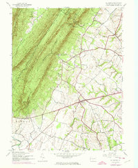
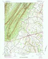
1944 Map of St Thomas
USGS Topo · Published 1974About this map
Kittatinny Mountain and Front Mountain dominate the northwestern landscape of this mid-century Franklin County survey, separated by the narrow corridors of Valley Run. The map illustrates the sharp transition between the wooded heights of the Letterkenny State Forest and the agricultural valleys to the southeast. Small settlements like Edenville and St Thomas are connected by a network of local roads and a prominent Pipeline cutting across the terrain. Historical industrial sites such as Franklin Furnace hint at the earlier economic activities of the region, while landmarks like Parnell Knob and Nancys Saddle provide specific points of interest for local historians and genealogists tracing family lands. Waterways including W Br Conococheague Creek and Back Creek define the drainage patterns of this rural Pennsylvania territory.
Find a feature on this map
27 named features on this map. Tap any name to fly to it.
Don’t see what you’re looking for? This feature index may not catch every label — zoom into the map to look around manually.
Map Details
Editions of this 1944 St Thomas Map
5 editions found
Other maps of this area

1900 · Mercersburg
USGS Topo · 1:62,500

1902 · Chambersburg
USGS Topo · 1:62,500

1902 · Mercersburg
USGS Topo · 1:62,500

1923 · Shippensburg
USGS Topo · 1:62,500

1939 · Orbisonia
USGS Topo · 1:62,500

1940 · Orbisonia
USGS Topo · 1:62,500

1942 · Hagerstown
USGS Topo · 1:125,000

1943 · Hagerstown
USGS Topo · 1:125,000

1943 · Mercersburg
USGS Topo · 1:24,000

1943 · Chambersburg
USGS Topo · 1:62,500
Featured Places
- Metal Township, PA
- Hamilton Township, PA
- Letterkenny Township, PA
- Edenville, St. Thomas Township
- Peters Township, PA