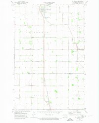
1972 Map of St. Thomas
USGS Topo · Published 1974About this map
The town of St Thomas serves as the primary hub on this Red River Valley survey, situated alongside the Burlington Northern railroad. The surrounding landscape is characterized by its organized agricultural grid, punctuated by landmarks such as the St Thomas Municipal Airfield and the Sewage Disposal Ponds just south of the town center. Local drainage is managed by a network of waterways including Willow Creek and the extensive County Ditch No 67A, which snakes through the eastern townships.
Find a feature on this map
16 named features on this map. Tap any name to fly to it.
Don’t see what you’re looking for? This feature index may not catch every label — zoom into the map to look around manually.
Map Details
Editions of this 1972 St. Thomas Map
2 editions found
Other maps of this area

1939 · Glasston
USGS Topo · 1:62,500

1941 · Glasston
USGS Topo · 1:62,500

1943 · Grafton
USGS Topo · 1:62,500

1944 · Crystal
USGS Topo · 1:62,500

1952 · Thief River Falls
USGS Topo · 1:250,000

1956 · Thief River Falls
USGS Topo · 1:250,000

1957 · Thief River Falls
USGS Topo · 1:250,000

1960 · Grafton
USGS Topo · 1:24,000
1960 · Oakwood
USGS Topo · 1:24,000

1963 · Crystal SE
USGS Topo · 1:24,000