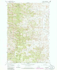
1966 Map of Stacey
USGS Topo · Published 1986About this map
Custer National Forest dominates this landscape, where the high point at Liscom Butte overlooks a complex network of drainages and springs. The small settlement of Stacey is situated in the north along Pumpkin Creek, serving as a focal point for the surrounding ranching and forestry activities in the mid-1960s. The presence of the South Stacey Sch and the Whitetail Ranger Sta suggests a structured but sparse community infrastructure centered on land management and local education.
Find a feature on this map
39 named features on this map. Tap any name to fly to it.
Don’t see what you’re looking for? This feature index may not catch every label — zoom into the map to look around manually.
Map Details
Editions of this 1966 Stacey Map
2 editions found
Other maps of this area

1954 · Hardin
USGS Topo · 1:250,000

1954 · Ekalaka
USGS Topo · 1:250,000

1956 · Ekalaka
USGS Topo · 1:250,000

1957 · Hardin
USGS Topo · 1:250,000

1958 · Ekalaka
USGS Topo · 1:250,000

1958 · Hardin
USGS Topo · 1:250,000

1965 · Ekalaka
USGS Topo · 1:250,000

1966 · Coleman Draw
USGS Topo · 1:24,000

1966 · Stacey
USGS Topo · 1:24,000

1966 · Home Creek Butte
USGS Topo · 1:24,000