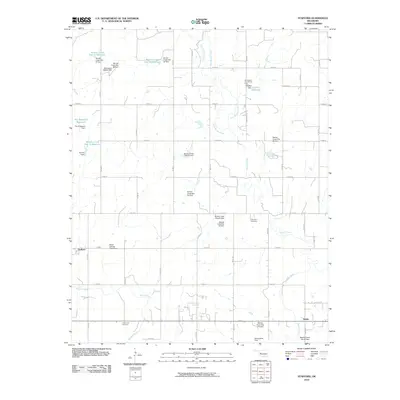
2010 Map of Stafford
USGS Topo · Published 2010About this map
Stafford and Ralph anchor this agricultural landscape in Custer County, where the plains are defined by an extensive network of water management features. The Washita River cuts across the southern portion of the quadrangle, while Barnitz Creek and its tributaries, West Barnitz Creek and East Barnitz Creek, dominate the central and northern drainage. This 2010 survey highlights a sophisticated system of flood control and irrigation, evidenced by numerous numbered sites like Barnitz Creek Site 57 Reservoir and the Butler Laterals Site 8 Dam. Local history is preserved at the Cabaniss Cemetery and Valley View Cemetery, while the Sunnyside Community Hall suggests a focal point for the rural population. The grid of section roads, including E 0980 RD and N 2200 RD, provides the framework for the region's farms and homesteads, reflecting the enduring legacy of the Land Run and subsequent settlement patterns in western Oklahoma.
Find a feature on this map
51 named features on this map. Tap any name to fly to it.
Don’t see what you’re looking for? This feature index may not catch every label — zoom into the map to look around manually.
Map Details
Editions of this 2010 Stafford Map
This is the sole edition of this map. No revisions or reprints were ever made.
Other maps of this area

1955 · Clinton
USGS Topo · 1:250,000

1956 · Cordell
USGS Topo · 1:62,500

1957 · Clinton
USGS Topo · 1:250,000

1957 · Butler
USGS Topo · 1:62,500

1957 · Clinton
USGS Topo · 1:62,500

1957 · Dill City
USGS Topo · 1:62,500

1976 · Butler NW
USGS Topo · 1:24,000

1976 · Butler NE
USGS Topo · 1:24,000

1976 · Butler SW
USGS Topo · 1:24,000

1976 · Dill City NE
USGS Topo · 1:24,000