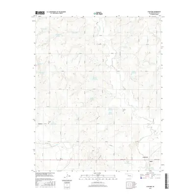
2016 Map of Stafford
USGS Topo · Published 2016About this map
The Washita River meanders across the southern portion of this landscape, a region defined by an extensive network of water management sites. The upper reaches of the Clinton area appear in the southeast, while the smaller settlement of Stafford sits further west. This 2016 survey documents a modern rural environment where historic burial grounds like Stafford Cem and Cabaniss Cem remain as markers of early community centers. The geography is notable for the sheer density of the Barnitz Creek flood control structures, including the Barnitz Creek Site 61 Reservoir and Barnitz Creek Site 66 Reservoir, which dot the terrain between Sunnyside Rd and Canyon Ridge Rd. These reservoirs, along with Hadley Reservoir and Roy Sheppard Reservoir, illustrate a highly engineered approach to managing the Oklahoma plains' drainage systems.
Find a feature on this map
48 named features on this map. Tap any name to fly to it.
Don’t see what you’re looking for? This feature index may not catch every label — zoom into the map to look around manually.
Map Details
Editions of this 2016 Stafford Map
This is the sole edition of this map. No revisions or reprints were ever made.
Other maps of this area

1955 · Clinton
USGS Topo · 1:250,000

1956 · Cordell
USGS Topo · 1:62,500

1957 · Clinton
USGS Topo · 1:250,000

1957 · Butler
USGS Topo · 1:62,500

1957 · Clinton
USGS Topo · 1:62,500

1957 · Dill City
USGS Topo · 1:62,500

1976 · Butler NW
USGS Topo · 1:24,000

1976 · Butler NE
USGS Topo · 1:24,000

1976 · Butler SW
USGS Topo · 1:24,000

1976 · Dill City NE
USGS Topo · 1:24,000